A Geologic Overview of Lake Powell, Utah
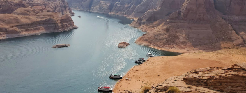
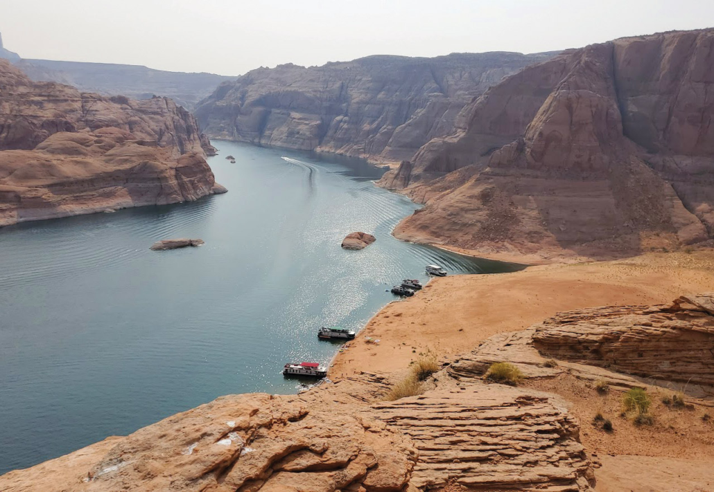
Nestled within the Glen Canyon National Recreation Area (GCNRA), Lake Powell is a testament to both human ingenuity and the enduring power of nature. The lake fills the entirety of the 170 mile length of Glen Canyon. Sometimes referred to as Utah’s “sixth national park,” this vast reservoir offers a unique blend of recreation and stunning geological beauty. Its sheer size and intricate shoreline distinguish it from any of Utah’s other lakes, while its geological story reveals a complex and fascinating past.
The first recorded European encounter with Glen Canyon comes from the Domínguez-Escalante Expedition of 1776. Just a few months after Thomas Jefferson signed the Declaration of Independence, the two Spanish explorers spent several weeks being led by Native American guides across a narrow passage through the canyon’s nearly impenetrable walls. Almost one hundred years later in 1869, John Wesley Powell, the lake’s namesake, explored the area by boating down the Colorado River and wrote the first known geologic investigation of the region.
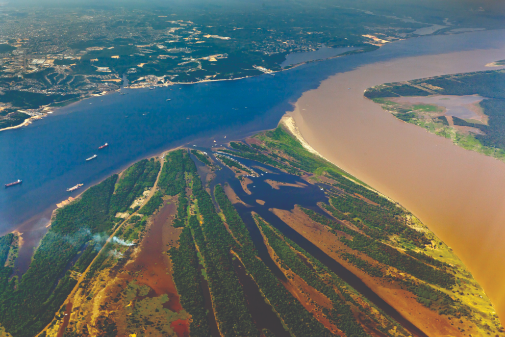
Almost another century later, in 1956, construction began for Glen Canyon Dam near the Utah-Arizona border. Designed to regulate and store water from the Colorado River Basin for six states—Utah, Colorado, Arizona, New Mexico, Nevada, and California—the dam also became a vital source of hydroelectric power. Its construction followed years of debate among government agencies, conservationists, and water resource planners, underscoring its enduring role in regional water management and the ongoing discussions surrounding its impact. The completion of the dam led to the formation of Lake Powell, one of the largest reservoirs in the United States.
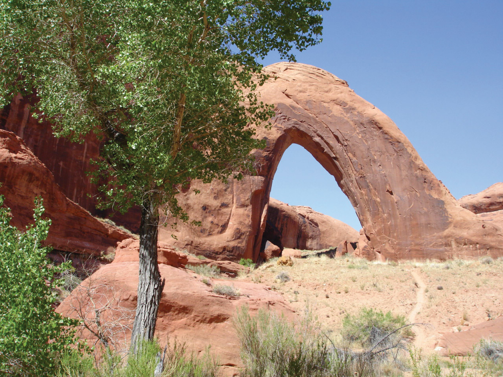
Perhaps Lake Powell’s most unique feature is its expansive cliff-lined shores. At full pool, its shoreline stretches greater than 1,900 miles, a figure that dwarfs the entire west coast of the continental United States. This remarkable length is a product of the flooding of Glen Canyon’s intricate network of slot canyons and translates to a myriad of opportunities for exploration in the 96 major canyons and countless smaller coves and inlets. Adding to its allure are the numerous natural features found within the recreation area, most notably iconic natural bridges and arches like Rainbow Bridge, Coyote Natural Bridge, Halls Creek Bridge, Broken Bow Arch, LaGorce Arch Dand many more in Glen Canyon’s Escalante arm. These natural wonders, sculpted by millennia of erosion, punctuate the landscape and provide a glimpse into the canyon’s ancient geological history.
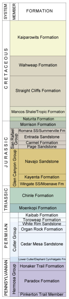
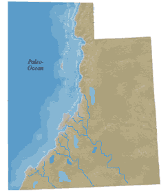
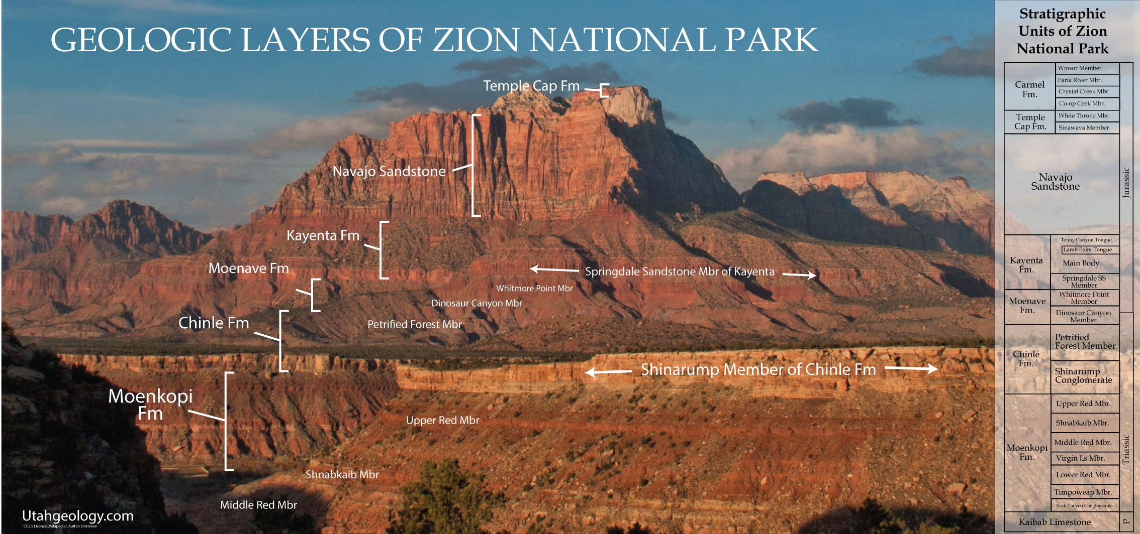
The geology of Glen Canyon is a story spanning hundreds of millions of years. It represents a continuous sequence of rock layers, ranging from Early Permian (~295 million years old) to Late Cretaceous (~75 million years old). The oldest exposed rock layer, the Permian-age Cutler Group, lies at the base of this geological sequence and is exposed on the flanks of the Monument Upwarp on the northeast end of the lake. Above the Cutler lies the Late Permian-age (~270 million years old) Kaibab Formation and the Early Triassic-age (~250 million years old) Moenkopi Formation, which is visible on both the northernmost and southernmost areas of Glen Canyon National Recreation Area. Overlying the Moenkopi is the Middle to Late Triassic-age (~230 million years old) Chinle Formation, known for its vibrant colors and abundant petrified wood.
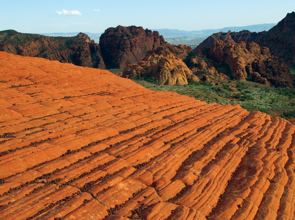
Perhaps the most impressive geologic unit in the region is the Early Jurassic-age (~200 to 190 million years old) Glen Canyon Group, a suite of sandstones that dominate the canyon’s landscape and borrows its name. This group consists of the Wingate Sandstone, known for its deep red sheer cliffs; the Kayenta Formation, characterized by its ledges and slopes of interbedded shale and sandstone; and the massive Navajo Sandstone, which forms large cliffs and slickrock canyons. This sequence of sandstones tells a story of ancient deserts with shifting sand dunes in a setting not unlike that of the modern Sahara Desert (see Survey Notes v. 44, no. 3). The entirety of the southern Utah Cretaceous sequence (~145 to 66 million years ago) is also visible from the southern and central parts of the lake, offering a complete picture of the region’s Mesozoic Era history.
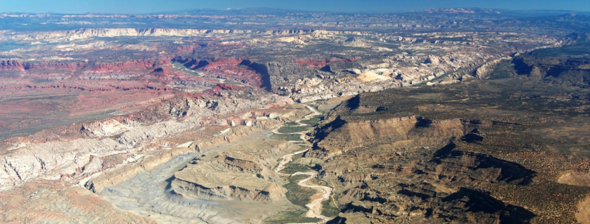
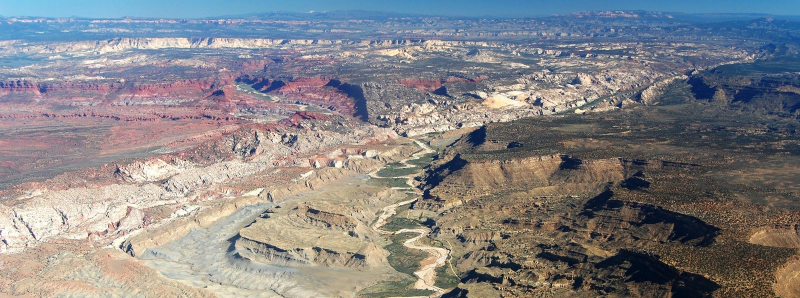
The impressive collection of canyons that compose Glen Canyon National Recreation Area were carved by the Colorado River and its tributaries long after the deposition and lithification of rock layers on the Colorado Plateau. The age of uplift and erosion that created the canyons, as well as the Grand Canyon, is a subject of ongoing debate. While the prevailing view suggests that the majority of the modern Glen Canyon’s erosion occurred within the last five million years, evidence of earlier erosional activity exists. Small streams cutting through the tightly folded strata of the Waterpocket Fold and East Kaibab Monocline hint at river systems in the area dating back at least to the Laramide mountain-building event some 70 to 40 million years ago.
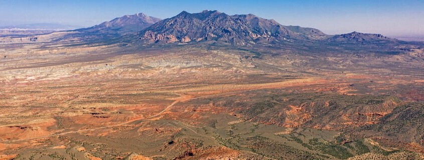
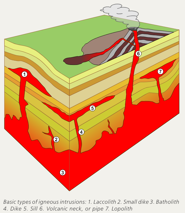
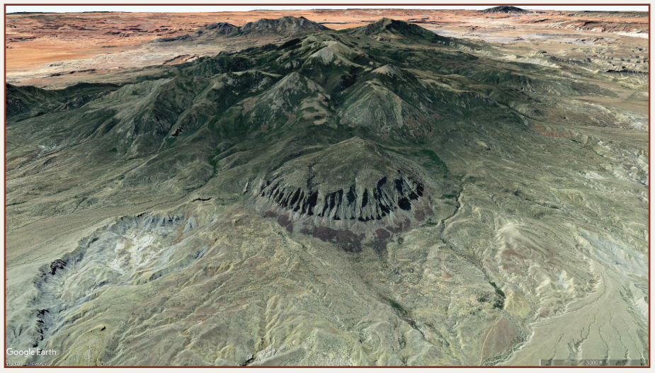
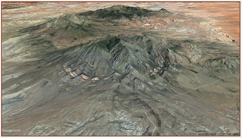
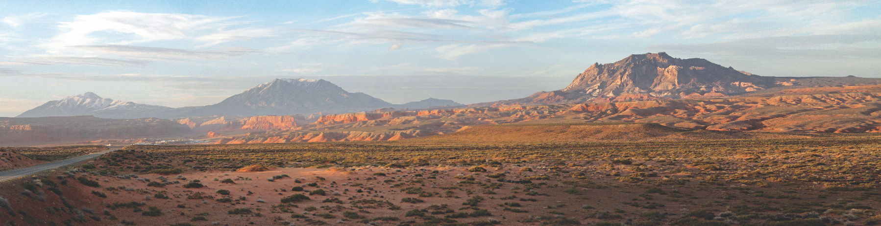
Part of what makes the geology of Lake Powell so unique is the juxtaposition of the lake’s completely level surface against the undulating regional geology. As one travels up lake from the dam, geologic rock formations separated by thousands of feet and millions of years take turns occupying the shorelines. This unique experience is caused by the regional folding of the Monument and Circle Cliffs Upwarps that have uplifted the lowest (oldest) layers to the surface in the northmost sections of the lake, exposing the Permian- and Triassic-age units. Conversely, downwarps like the Kaiparowits Basin, bring younger Cretaceous- and Late Jurassic-age layers to lake level. Adding to the geological intrigue are smaller geologic features visible from the lake, called laccoliths, caused by rising magma which bent the overlying rocks into unique dome-like structures seen at Navajo Mountain, Mount Ellsworth, and Mount Holmes.
Lake Powell stands as a significant testament to the interwoven forces of nature and human activity. It offers visitors a unique way to traverse Glen Canyon and explore its diverse topography and geology. The creation of this vast, and sometimes controversial, reservoir has transformed a once-wild, actively erosive landscape into a more tranquil blend of recreation and utility, offering visitors unparalleled access to breathtaking landscapes unique to those available up and downstream on the Colorado River.


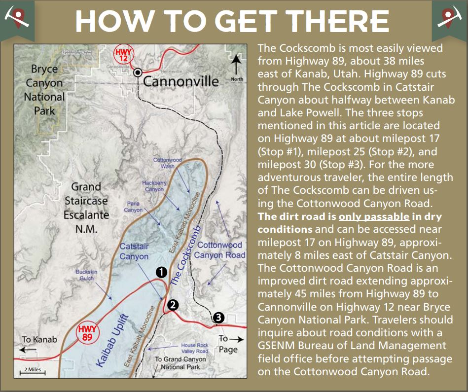
 The Cockscomb has a long geologic history that can be simplified into three phases. The oldest layers exposed at the base of this unique geologic feature were deposited between about 270 and 185 million years ago in the Permian to Early Jurassic periods. During this time, Utah was situated on the west coast of North America with much of present-day California and Nevada existing as offshore islands. Warm, shallow seas accumulated thick layers of siltstone and limestone which form the cap rock for much of the Kaibab uplift, but represent the lowest exposed layers of The Cockscomb. As North America drifted westward, Utah was uplifted above sea level, transitioning into a terrestrial environment of west-flowing rivers and streams that deposited thick layers of colorful sediments now exposed in the Vermilion and Chocolate Cliffs of The Cockscomb and Grand Staircase (seen best from Stop #1 on the map).
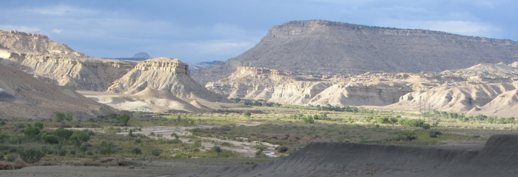
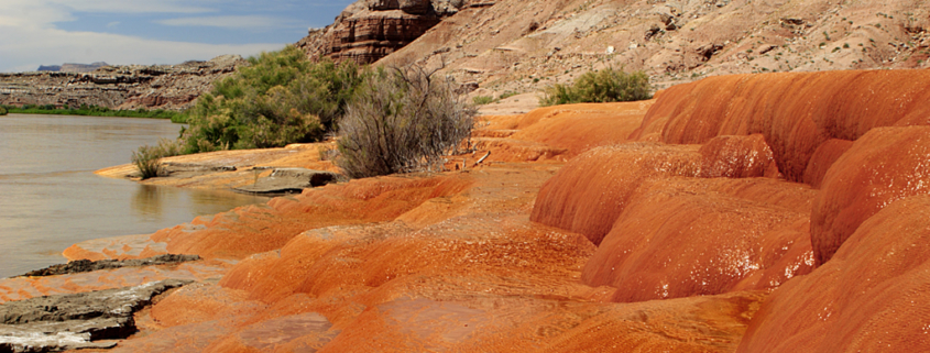
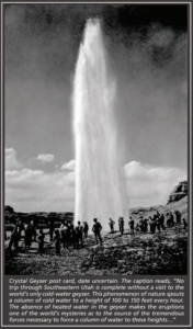
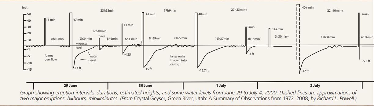
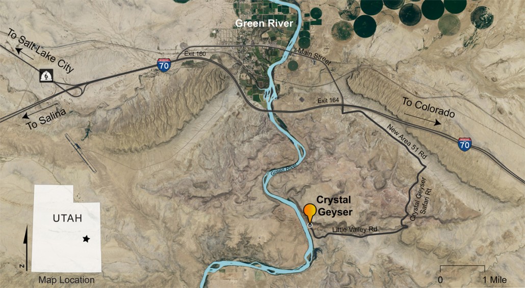
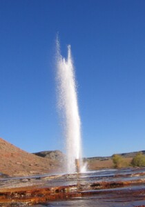 Crystal Geyser is a partially human-made geyser located on the shore of the Green River, approximately 10 miles south of the town of Green River, Utah. The geyser originated in 1936 when an oil exploration well tapped into a groundwater system under immense pressure caused by a reservoir of trapped carbon dioxide (CO2) gas. However, the high-pressure system that the well penetrated had previously created a series of ancient natural springs and tufa deposits which were first referenced by John Wesley Powell in 1869. On his way down from the present town site of Green River and the state park museum which now bears his name, he wrote, “an hour later, we run a long rapid, and stop at its foot to examine some curious rocks, deposited by mineral springs that at one time must have existed here, but are no longer flowing” (Powell, 1875, Report on the Exploration of the Colorado River of the West and Its Tributaries, p. 51–52).
 The well was abandoned after drilling to a total depth of 2627 feet, but in its aftermath, a geyser was created that quickly became a regional attraction. The November 1936 front page of Moab’s Times-Independent boasted of a new geyser that spouted an 80-foot column of water at regular intervals of about 15 minutes and a 150-foot column at intervals of about 9 hours.


