Geologic Formation Selection Map
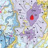 Use this selection map to find information on geologic formations. Formation descriptions are old and out of date, but check back as we update our descriptions with more relevant information.
Geologic Formations of Utah Overview
Section Summary
Accessible from the selection map, and under heavy construction, this section contains/will contain pictures, thickness maps, cross sections, and overviews for each of the major formations of the Colorado Plateau. Each formation overview begins with a short summary of the formation and then goes into more detail concerning the layer. You can change formation pages by selecting one from the drop down at the top of each page, or by clicking one from the map.
Formation Gallery & User Comments
Each formation page has a banner of pictures dynamically pulled from the formation gallery. A link is also provide to the formation gallery where uses can go to upload pictures (with permission) or post comments on pictures already in the formation gallery. In time the formation gallery should contain hundreds of pictures of each of the Colorado Plateau’s formations with helpful comments which explain different aspects of the formations as shown in the various pictures.
Formation Thickness Map
Each formation page will have an isopach map showing the average thickness of the layer throughout the Colorado Plateau. In time we will create a map which dynamically pulls layer thicknesses from the stratigraphic column database. This will help in understanding the extent and depositional environment of the formation.
Stratigraphic Equivalents
At the top of each formation there will also be a link to diagrams showing the stratigraphic equivalents or name correlations of the layer as it crosses the state and Colorado Plateau. I will also show and discuss facies changes. Hopefully we can begin to standardize formation names to alleviate confusion caused by formations being named with multiple names.
Selection Page
On the click map you can select a formation from the drop down list or click on the corresponding button of the geologic map to go to the formation page.
User Forum
The user forum is a place where users can go to comment and share ideas on geologically related topics. In particular, the formation section of the forum is a place where questions and comments on a particular formation can be discussed. This will also be an excellent place for people to share their findings or unique ideas about a particular formation.
Utah Interactive Map Viewer
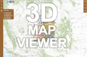
I’ve spent 15 years working on this interactive map viewer as a portal to hundreds of geologic maps for Utah and the Colorado Plateau. Maps are housed on the Utah Geologic Survey’s ArcGIS Map Server. Link opens in a new window.
Geologic Formation Dynamic Pages
- Tertiary Rhyolites
- Claron Formation
- Kaiparowits Fm
- Mesa Verde Ss
- Mancos Shale
- Dakota Sandstone
- Morrison Formation
- Summerville Fm
- Entrada Sandstone
- Carmel Limestone
- Page Sandstone
- Navajo Sandstone
- Kayenta Formation
- Wingate Sandstone
- Chinle Formation
- Moenkopi Formation
- Kaibab Limestone
- Toroweap Formation
- Coconino Sandstone
- Hermit Shale
- Supai Group
- Redwall Limestone
- Muav Limestone
- Bright Angel Shale
- Tapeats Sandstone
- Vishnu Schist
Geologic Formation Static Pages
- Tertiary Rhyolites, Claron Formation, Kaiparowits Fm, Mesa Verde Ss, Mancos Shale, Dakota Sandstone, Morrison Formation, Summerville Fm, Entrada Sandstone, Carmel Limestone, Page Sandstone, Navajo Sandstone, Kayenta Formation, Wingate Sandstone, Chinle Formation, Moenkopi Formation, Kaibab Limestone, Toroweap Formation. Coconino Sandstone, Hermit Shale, Supai group, Redwall Limestone, Muav Limestone, Bright Angel Shale, Tapeats Sandstone, Vishnu Schist