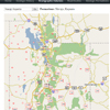
Strat Columns Selection Map
Stratigraphic Columns Overview
Section Summary
Accessible from the selection map, the stratigraphic columns section will eventually be one of the most extensive parts of our database. At some point, this section will contain hundreds of stratigraphic columns from all over the Colorado Plateau. The columns will follow the standard USGS format for stratigraphic columns, containing columns for formation and group/member names, age, thickness, and lithology. Because the internet allows more interaction, however, every part of the columns will be linked to more data. Below (coming soon) is an example of the interactive nature of the columns, and a description of what each link does.
Geologic Period Column
Clicking the geologic period in this column will take you to the corresponding paleogeography page for that period (see paleogeography section).
Formation Column
Clicking on the formation column will take you to the formations page found in the geologic formations section of this website, which will in turn have links to cross sections, thickness maps, pictures, and the users forum where viewers can submit pictures of formations and add their own comments and insights to them.
Thickness Column
Clicking the given thickness in the thickness column will take you to a link of the thickness map with the selected formation’s thickness. .
Rock Type Symbol
Clicking on the rock type symbol will show pictures of the formation with emphasis on significant bedding patterns and other up-close detail information?
Side Notes
Clicking on the some of the side notes will show pictures pertaining to the note, most especially pictures of unconformities, tracks, and fossils.
Column Name
Clicking on the column name or some link next to it, will open an album of aerial pictures for the area, or pictures that show areas with large exposures of many fms.
FOLLOW THESE LINKS FOR STRAGIGRAPHIC COLUMNS TO THE FOLLOWING AREAS
- South Cental Idaho – Malta
- South Cental Idaho – Black Pine Mtns
- Rosette – Raft River Mtns
- Grouse Creek Mountains
- Goose Creek – Rhyolite Mountains
- Lucin Area
- Pilot Range
- Wendover – LeppyHills
- Silver Island Mts
- Newfoundland Mountains
- Lemay Island Area
- Terrace & Hogup Mountains
- Samaria Mountains
- Malad Range
- Brigham City – Wellsville Mtns
- Bear River Range
- Preston – Red Rock Pass
- South Bear Lake Valley
- Randolf – Crawford Mtns
- Pine View Area
- Promontory Range
- Ogden Canyon – Huntsville
- Wasatch Range – Ogden to Farmington
- Wasatch Range – Weber Canyon
- Grassy – Lakeside Mountains
- Skull Valley – Cedar Mountains
- Stansbury Range
- Oquirrh Mtns – Bingham/Magna
- Simpson Mtns – Dugway
- Sheeprock Mountains
- Oquirrh Mts. – Ophir/Butterfield Canyon
- Tintic Mountains Area
- Wasatch Range – Salt Lake City Area
- Oakley – Park City – Kamas
- Wasatch Range – Utah Valley Area
- Thisle Area – Spanish Fork Canyon
- HWY 6 – Soldier Summit Area
- Uinta Basin – Hanna/Altamont Area
- Uinta Mtns – Flaming Gorge Area
- Split Mtns – Dinosaur National Monument
- Central Uinta Basin – Roosevelt Area
- Uinta Basin – White River Area
- Grand Junction Colorado
- North Deep Creek Range
- Sand Pass Fish Springs Mountains
- Trout Creek – So. Deep Creek Range
- Great Basin Natioan Park – Snake Range
- Topaz Res – Thomas & Keg Mountains
- Drum & Little Drum Mountains
- Skull Rock Pass – House Range
- Sevier Lake Area – Cricket Mountains
- Long Ridge – Current Creek
- Wasatch Range – Santaquin Canyon
- Cedar Hills Area – Near Fairview
- Wasatch Plateau – Fair View Canyon
- Jericho – Gilson/East Tintic Mtns
- N. West Hills – Levan
- Leamintgton Canyon – Canyon/Gilson Mtns
- Scipio Area – Pahvant Range
- San Pitch Mtns – Gunnison Plateau
- Denmark Pass – Valley Mtns
- Wasatch Plateau – Manti Area
- Book Cliffs – Huntington Area
- Book Cliffs – Price/Price Canyon
- Book Cliffs – Horse Canyon Area
- Book Cliffs – Green River Area
- Westwater Canyon – Cisco
- Garrison – Burbank Hills
- Kings Canyon – Confusion Range
- Hamblin Valley – Mtn Home Range
- Indian Peak Range
- Wah Wah Mountains
- Neelde Range – Blue Mtn
- San Francisco Mountains
- Black Mountains – Star Range
- Fillmore – I-15/I-70 Junction
- Richfield Sevier Plateau
- Salina Canyon – Salina
- Salina Canoyon – I-70 Summit
- San Rafael Swell – Coal Cliffs
- Factory Butte – Hanksville Area
- Canyonlands National Park
- Arches National Park Area
- Minersville – Mineral Mts
- Beaver Mountain – Sulpherdale
- Tushar Mtns – hw-20
- Otter Creek Res – Johns Valley
- Sevier Canyon – Marysvale Area
- Loa – Fish Lake Mountains
- Capitol Reef – Water Pocket Fold
- Henry Mtns – Circle Cliffs Area
- Modena – Enterprise Area
- Utah Hill – Goldstrike Area
- Cedar Canyon – Three Peaks
- Zion National Park – Cedar Mtn
- Kanab – Grand Staircase
- Bryce National Park – Escalante
- Grand Canyon National Park
- Glen Canyon – Lake Powell
- Monument Valley – Kayenta Area
- Abajo Mtns – Monticello/Bluff


