• Link to Facebook
  • Link to Instagram
  • Link to Youtube
  • Home
  • Tours
  • About
  • Contact
UtahGeology
  • Guided Tours
  • Hiking Guides
    • Geologic Hiking Guides
  • Geoarchaeology
    • Archaeology Explorer
    • Were the Ice Ages Caused by True Polar Wandering?
  • Geologic History
    • Utah Geologic History
    • Geologic History Overview
    • Geologic History of Utah & the Colorado Plateau
  • Road Guides
    • Utah Geologic Road Guides
    • Road Guides Overview
  • Geologic Formations
    • Geologic Formations
    • Geologic Formations Overview
  • Stratigraphic Columns
    • Utah Stratigraphic Columns
    • Stratigraphic Columns Overview
    • Layer Thickness Map
  • More
    • About
    • Contact
    • Geo Imagery
    • Earthquake Viewer
    • Interactive Map Gallery
    • Whats New?
    • Web Links
  • Click to open the search input field Click to open the search input field Search
  • Menu Menu
You are here: Home1 / The Best Earthquake Viewer on the Internet

The Best Earthquake Viewer on the Internet

Find recent or historic earthquakes, lists, or information on selected significant earthquakes at the resources below. The University of Utah Seismograph Stations helps reduce the risk from earthquakes in Utah through research, education, and public service. The United States Geological Survey mission is to monitor, analyze, and predict current and evolving dynamics of complex human and natural Earth-system interactions and to deliver actionable intelligence at scales and timeframes relevant to decision makers.

Global Recent Earthquake Viewer Global Recent Earthquake Viewer

Global Recent Earthquake Viewer

Global Earthquake Map with historic earthqakes and EQ statistics

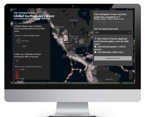
World Earthquake Explorer. Literally the worlds best earthquake viewer. Only at Utahgeology.com

(want to know if earthquakes are increasing in frequency or magnitude? Find it in the app.)

Find recent or historic earthquakes, lists, or information on selected significant earthquakes at the resources below. The University of Utah Seismograph Stations helps reduce the risk from earthquakes in Utah through research, education, and public service. The United States Geological Survey mission is to monitor, analyze, and predict current and evolving dynamics of complex human and natural Earth-system interactions and to deliver actionable intelligence at scales and timeframes relevant to decision makers.

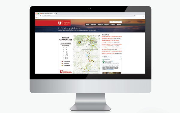
University of Utah Seismograph Stations earthquake viewer. Not nearly as cool as ours, but we’ll give them points for trying.

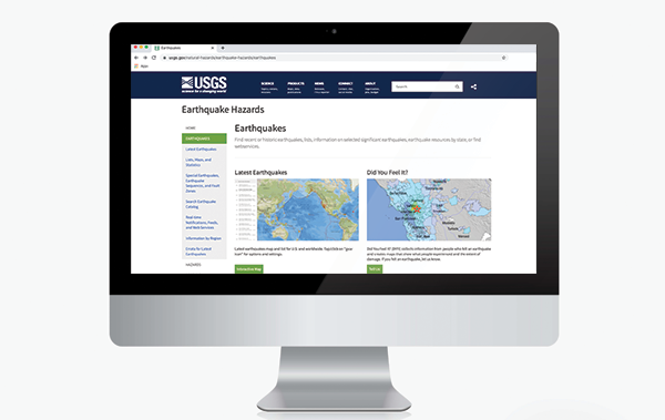
United States Geological Survey. Also not nearly as cool as ours, but useful non-the-less.

3D viewer of Worldwide earthquakes of the last 12 months 3.5+: Click to explore an interactive map of 3.5+ earthquakes that have occurred worldwide in the last 12 months

Historical Earthquakes

Studies of historical earthquakes provide a basic background for projecting future seismic hazards and losses.

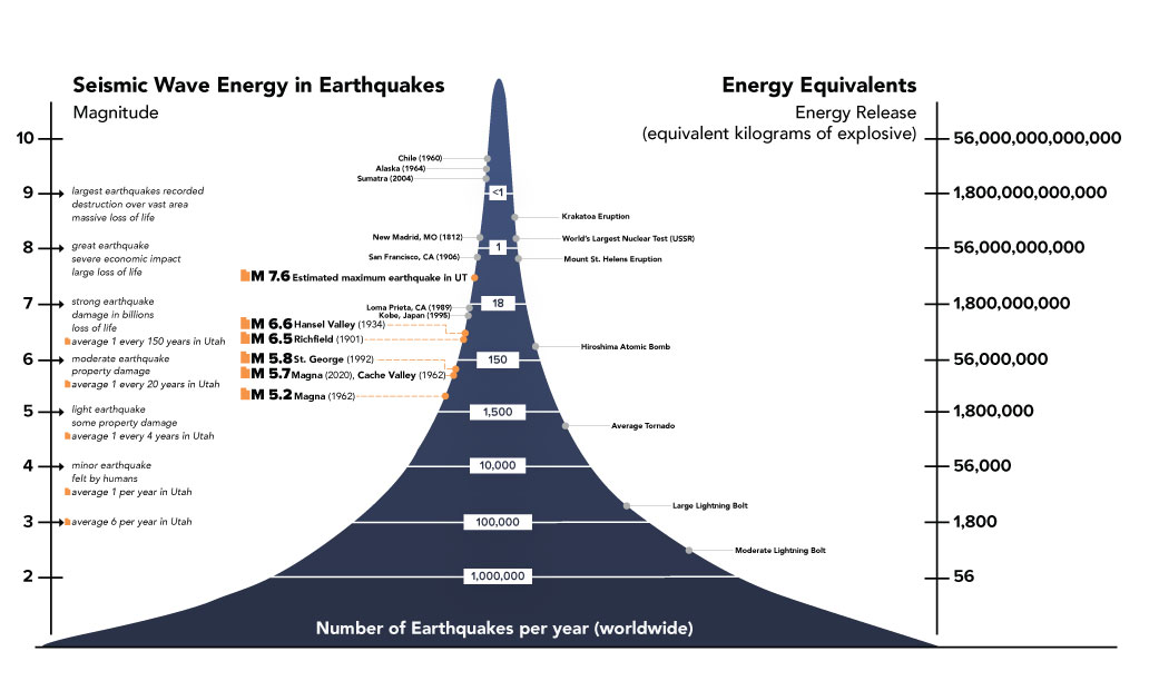
Magnitudes of historical earthquakes compared with energy release from other natural and man-made events. (Modified from Incorporated Research Institutes for Seismology, IRIS)

Geology of Earthquakes in Utah

Utah has experienced 17 earthquakes greater than magnitude 5.5 since pioneer settlement in 1847, and geologic studies of Utah’s faults indicate a long history of repeated large earthquakes of magnitude 6.5 and greater prior to settlement. Utah is not on a boundary between tectonic plates where most of the world’s earthquakes occur, but rather is in the western part of the North American plate. However, earthquakes in Utah are related to interactions with the Pacific plate along the plate margin on the west coast of the United States.

There is a 57% probability that the Wasatch Front region will experience at least one magnitude 6.0 or greater earthquake and a 43% probability of at least one magnitude 6.75 or greater earthquake in the next 50 years.

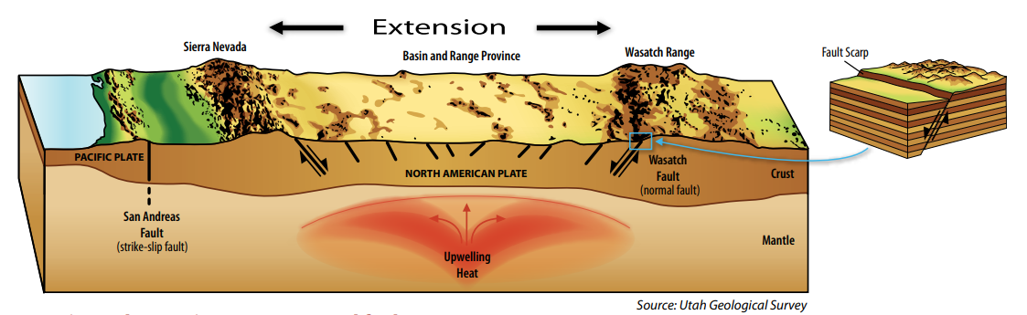
Stretching, or horizontal extension, of the crust produces a type of dipping (or inclined) fault called a “normal” fault. The movement of normal faults is characterized by the crust above the fault plane moving down relative to the crust below the fault plane. This up/down movement differs from movement on strike-slip faults like the San Andreas in California, where the crust on one side of the fault slides horizontally past the crust on the other side. Putting Down Roots in Earthquake Country

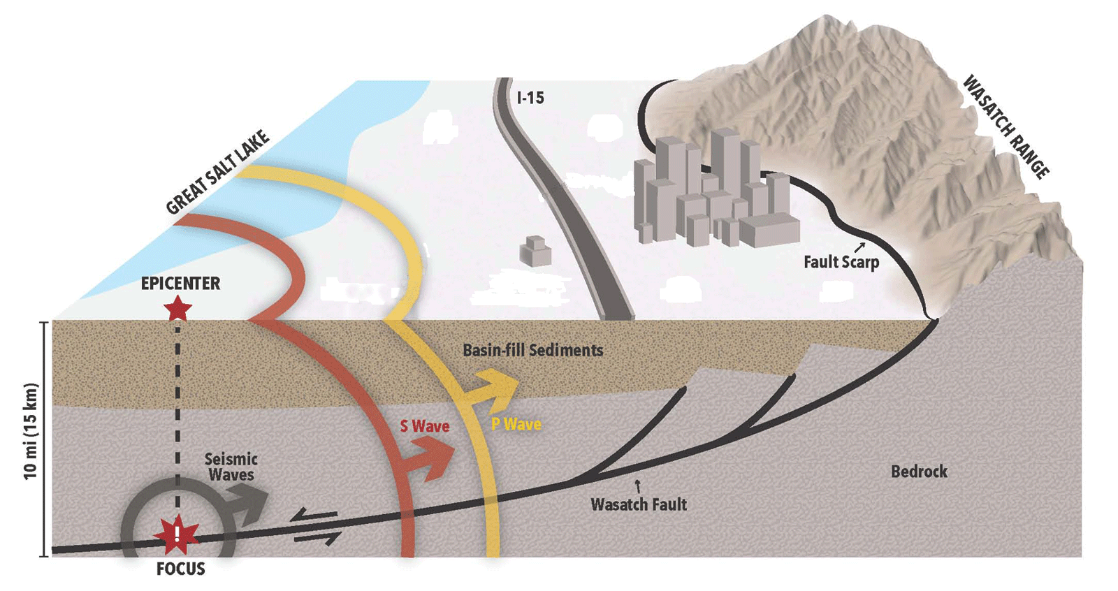
Generalized cross section showing a fault rupture which causes an earthquake and generates seismic waves. This is a conceptual diagram of how the Wasatch fault affects the Salt Lake Valley and does not show any specific seismic event.

Image

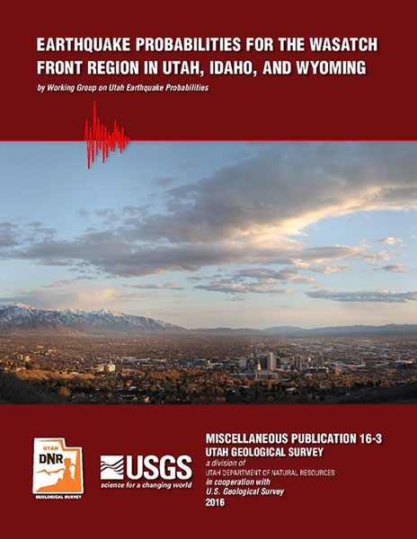
Earthquake Probabilities for the Wasatch Front Region

Image

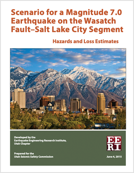
Scenario for a Magnitude 7.0 Earthquake on the Wasatch Fault

Image

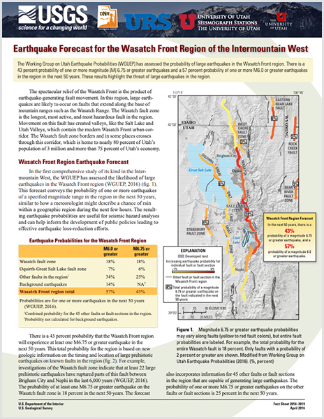
Earthquake Forecast for the Wasatch Front Region of the Intermountain West

Putting Down Roots in Earthquake Country, 2nd Edition
Your Handbook for Earthquakes in Utah.

Welcome

About me
Lance Weaver. about me.


Book a Tour

Popular
  • Were the Ice Ages Caused by True Polar Wandering?September 21, 2020 -
  • Navajo SandstoneApril 16, 2015 -
  • Take Away Lessons from my Experience with the Jerold Williams...August 10, 2015 -
  • The Vishnu SchistNovember 14, 2018 -
  • The Geology of Zion National ParkNovember 14, 2018 -
  • Utah’s Three Types of VolcanoesMay 26, 2015 -
  • A Geologic Overview of Lake Powell, UtahFebruary 15, 2026 -
  • CASCADE FALLS, KANE COUNTY, UTAHApril 16, 2015 -
Recent
  • A Geologic Overview of Lake Powell, UtahFebruary 15, 2026 -
  • Pine Park and the Ancient Supervolcanoes of Southwestern...February 15, 2026 -
  • The Weaver Precessional Polar Oscillation Cycle & Core-Mantle...January 3, 2026 -
  • A Revised Egyptian Chronology. Errors in Early Iron Age...September 26, 2025 -
  • Supai & Hermosa Group / Weber Sandstone (Geology of...May 9, 2025 -
  • Esplanade Sandstone & Cutler Cedar Mesa Sandstone (Geology...May 7, 2025 -
  • Hermit/Organ Rock (Geology of The Grand Canyon)May 5, 2025 -
  • Toroweap/Coconino/White Rim Sandstone (Geology of The Grand...May 5, 2025 -
Comments
  • Gabor Szuecs dr.Because the pole was not where it is today. Around the year...February 8, 2026 - by Gabor Szuecs dr.
  • Alan FullerUpdate to previous post. After a more thorough read I have...December 30, 2025 - by Alan Fuller
  • Alan FullerFantastic piece of work I think you have basically described...December 26, 2025 - by Alan Fuller
  • Lance WeaverNo. Despite what some say, there are no specific 'angles'...November 21, 2025 - by Lance Weaver
  • Mark RademakerLance, i have read that the cross beds of Checkerboard Mesa...November 9, 2025 - by Mark Rademaker
  • Gabor Szücs MDIt's been about 18 years since I first thought of this anomaly....April 21, 2025 - by Gabor Szücs MD
  • Lance WeaverYep, someone pointed that article out to me (and the way...November 1, 2024 - by Lance Weaver
  • Rick DewhirstHey Lance,I have just stumbled across your article and...November 1, 2024 - by Rick Dewhirst

Follow us on Facebook

UtahGeology
Logo image
Go to facebook page
Join the Facebook community!

Tag Cloud

Frontpage Article Geoarchaeology Geologic Formation Pages Geologic Hiking Guides Images News Uncategorized

Important Pages

Privacy Policy,    About utahgeology.com,    Contact US

Relevant Links

  • Utah Geological Survey
  • U.S. Geological Survey
  • Arizona Geology Blog
  • Durango Bill
  • Zion Experiences

Contact Me

Utahgeology is a 501c nonprofit. If you would like to contact me, drop me a line from the contact page. Or if you have questions about geology, call me during normal work hours at the Utah Geological Survey.
© Copyright - UtahGeology - Enfold Theme by Kriesi
  • Link to Facebook
  • Link to Instagram
  • Link to Youtube
Scroll to top Scroll to top Scroll to top