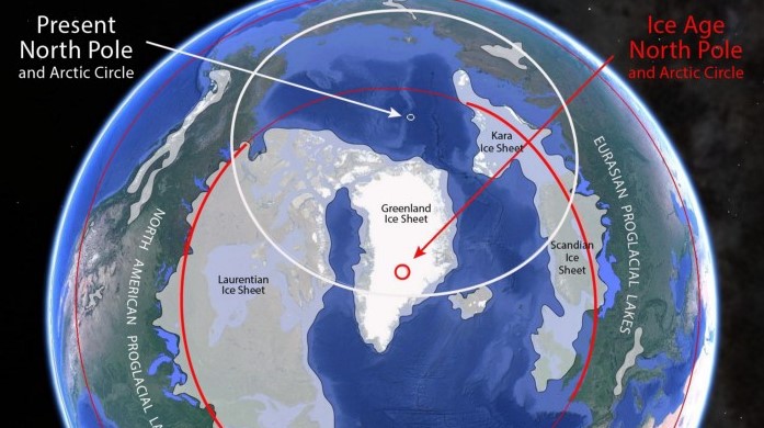
This interactive globe app helps to visualize how the Pliestocene 'Ice Age' may have actually been a period of altered polar axis (ie. the north pole was over greenland instead of its present location).

Us geologists refer to a change in the earth's rotational axis as 'True Polar Wandering Events' (TPW). Such events are well known in the geologic record but the timing, duration and frequency are debated. (With most models suggesting only >1Ma+ durations for rapid shifts and slow TPW & apparent polar wander (APW) matching essentially with general tectonic plate drift).
A recent (post pliestocene) rapid TPW event seems evident by investiagating the positioning of the ice sheet and lack of Continental Glaciers in Siberia & Alaska during the Last Glacial Maximum.
In the application black denotes modern latitude lines, and white denotes the apparent Pliestocene Arctic circle and latitude lines.
Note how the extent of the ice during 'Ice Age' was actually not much bigger than the current Arctic or Antarctic circles. (With the exception of 'Alpine Glaciers' such as the Canadian Rockies, Alps, Russian Mountains, etc. )
Ice polygons are taken from the current scientific consensus on continental ice age glacial extents. (See here and here).
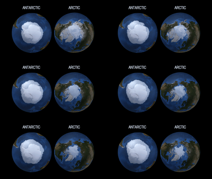
Toggle on the following 'Antarctic overlay layer' to see the current extent or size of Antarctica with its associated winter sea ice superimposed upon
the extent of the ancient northern hemesphere ice sheet. You'll see how the pleistocene ice sheet was essentially what would be expected of a different polar location, if we use the modern Antartic glacial extent as an analog.
