Geologic Hiking Guides (Geology Jaunts) and SurveyNotes Articles
If you’d rather be your own guide, read our latest geologic hiking guides and Informative Survey Notes Articles. This section houses many of our geologic hiking guides to popular locations in Utah such as Zion National Park and even the Grand Canyon, where geologists and geology enthusiasts can come to find hiking guides for many of the popular trails and hikes in Utah which showcase spectacular or noteworthy geology!
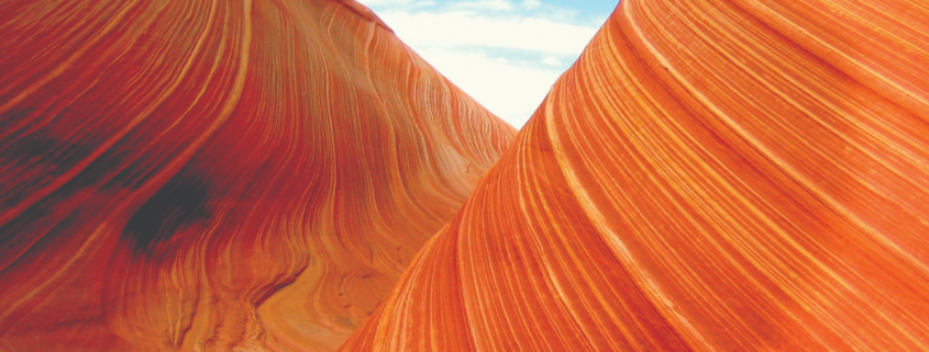
What Makes the Rock Red (in Utah/Arches & Zion National Park)
Utah’s Colorado Plateau is famous for its striking vistas and dazzling colors. Hues of red, pink, maroon, yellow, brown, and white create an array of stunning rock colors that attract visitors from all over the globe. From the red rocks of the Navajo Sandstone to the Vermilion Cliffs of the Moenave and Kayenta Formations to the pink, crimson, and chocolate cliffs of the upper Grand Staircase, many who visit the Colorado Plateau wonder what gives the rocks their brilliant colors.
The Cockscomb Monocline & Cottonwood Wash of Grand Staircase Escalante National Monument
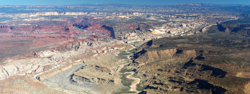
Tourists and geologists alike come from all over the world to see and study the magnificent exposures of geologic units displayed in Utah’s Colorado Plateau region. Of particular interest is the Grand Staircase, which is an immense sequence of sedimentary rock layers that stretches south from Bryce Canyon National Park and Grand Staircase–Escalante National Monument […]
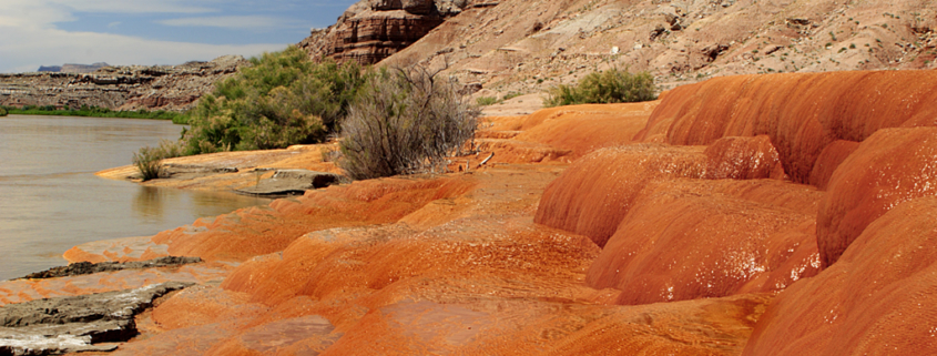
Utah’s Not So Old Faithful, Crystal Geyser
When most people think about geysers, they picture a Yellowstone- like hot spring where pressure from steam sends a tall column of water into the air. In Utah, however, several “geysers” erupt due to the same process that causes soda pop to shoot out of the can when you hold your finger over t he […]
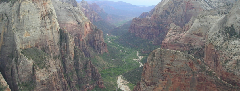
The Geology of Zion National Park
Although the geology of the Zion National Park includes nine known exposed formations, Zion is predominately the result of one spectacular unit, the Navajo Sandstone. Zion’s formations represent about 150 million years of mostly Mesozoic-aged sedimentation in a large ancient Jurassic basin. The Navajo is part of a super-sequence of rock units called the Grand Staircase, the time exposed […]
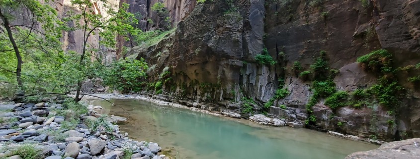
The Virgin River Narrows (how far is it? geology of?)
What is the Zion Virgin River Narrows? (Zion National Park) The Narrows is the narrowest section of Zion Canyon. It is an 18 mile gorge or canyon filled by the Virgin River just upstream from the part of Zion where the roads and trails end. This gorge, with walls a thousand feet tall and the […]
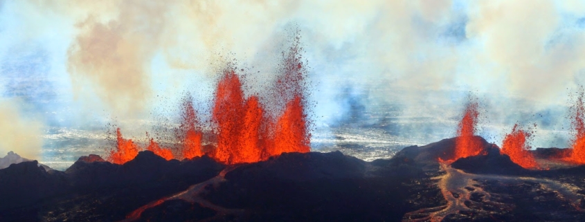
Utah’s Three Types of Volcanoes
Perhaps because it is covered in detail in Grade School and Middle School curriculum, one of the most asked geologic questions I hear from youth has to do with differentiating between the three types of volcanoes. Three Main Types of Volcanoes* The three main types of volcanoes differ in shape, size, and make-up; the differences […]
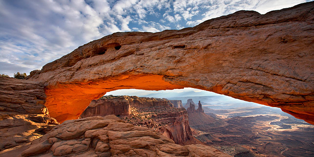
How Are Arches Formed?
Utah’s sandstone units tend to be exposed on the flanks of large gentle uplifts …
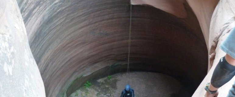
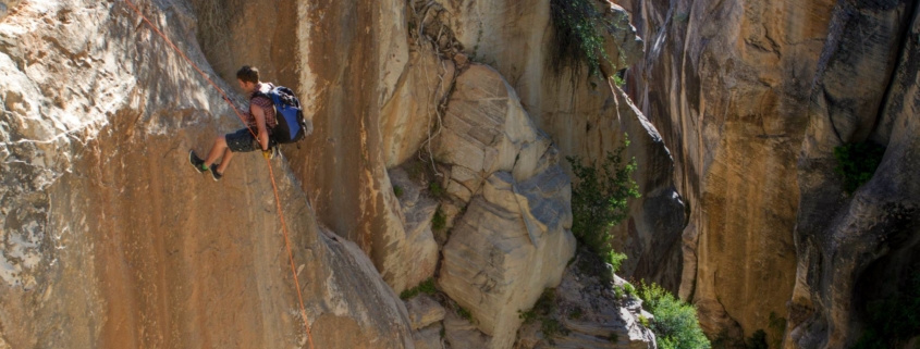
Keeper Potholes & How They Are Formed
Keeper potholes are found in slot canyons. In the recent decades “slot” canyoneering has become a major sport, and very few areas of the world have nearly the number or diversity of slot canyons as southern Utah. People come from all over the world to descend slot canyons of varying difficulty in places such as Zion National Park, Grand Staircase–Escalante National Monument, Capitol Reef National Park, the San Rafael Swell, and Glen Canyon National Recreation Area.
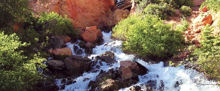
CASCADE FALLS, KANE COUNTY, UTAH
Nestled in the northwestern corner of Kane County is a geologically unique feature that receives relatively few visitors. Although most people in Utah have seen caves and waterfalls, it is peculiar for a waterfall to emerge from a cave system. Cascade Falls does just that, as an underground river emerges from a deep cave system and cascades down a steep cliff face.